Showing posts with label Swan River. Show all posts

Sunday, 21 January 2018

Perth Stadium: Bike-Car from Rivervale

Perth Stadium finally opens to the public for the first time today. It's a 60,000 seat sporting arena located on a peninsula with very restricted access for motor vehicles.


Travelling to the stadium will require a change of thinking for many Western Australians who don't consider travelling in anything but a car or a plane. The state government has designed a transport plan that focuses on trains and buses. Here is a recent advertisement promoting both modes.


Some Western Australians have an aversion to public transport. I know people who have lived within walking distance of Murdoch station for ten years and have never caught a train. 

One way to avoid the crowded public transport is to ride a bike. If you live close enough there are safe and easy routes to the stadium. For people living further away, using a combination of bike and car is a logical solution. Put the bikes on the back of the car and drive to a spot within riding range.

The bike-car solution may not be as praiseworthy as bike-only, or bike-train, but for those living in areas not well-serviced by public transport it's a realistic option. 

My bike-car suggestion for this week is Rivervale.


Park in Tanunda Drive at the rear of this building. From this point it is an easy three-kilometre ride to the stadium along a shared path. There are some hills but it is suitable for people aged 5 to 80.


You might get a car park on the street but there are also about 150 off-street bays that are not used on weekends.


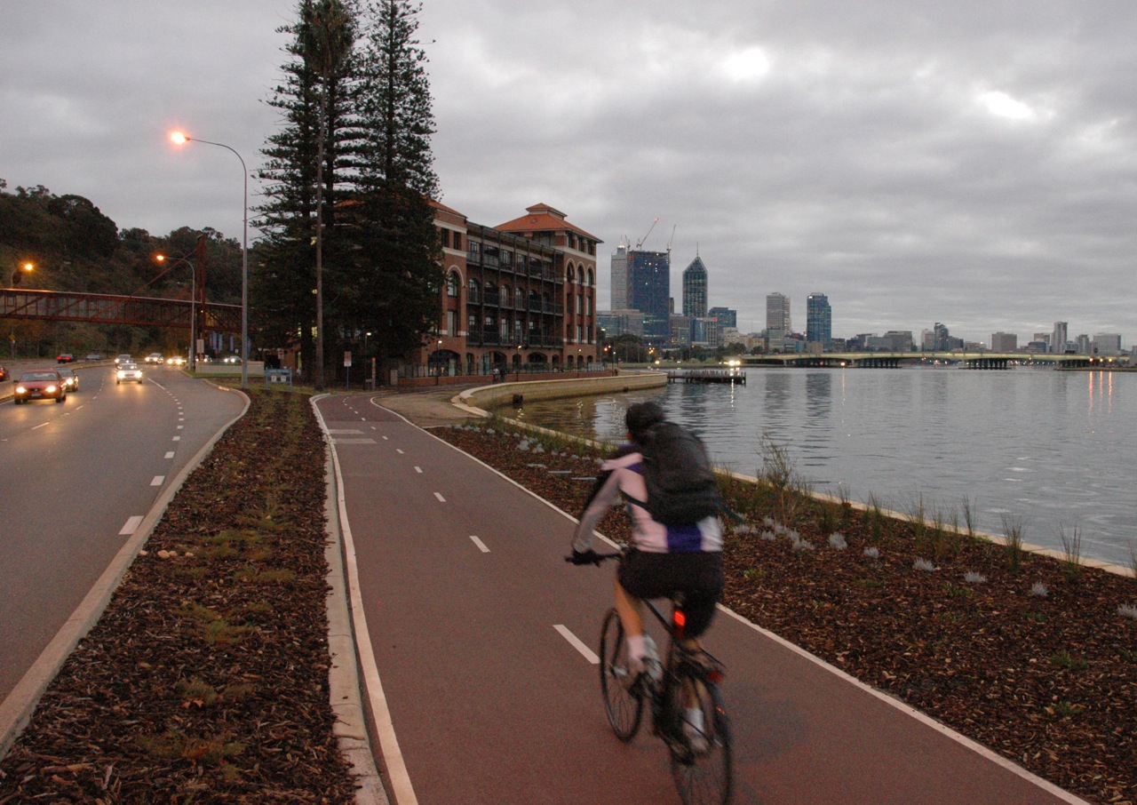
Directly behind the car park is a shared path that travels along the river. There's even a convenient water fountain to fill your bottles.


Travel down the hill and stay on the river side of the apartments. This path will take you along a very pleasant and shady route to the stadium.  


There are opportunities to stop along the way. There are small jetties, parks, picnic tables and a grassy beach.


The path opens onto a car park next to a popular water ski area. There is no need to ride through the car park. Turn left immediately and use the short section of path next to the toilet block to connect to the main Principal Shared Path beside Graham Farmer Freeway.


There are three streets to cross. The first is the entry to the ski area, with a low volume of traffic. The next two are controlled with traffic lights and are easy for all ages and abilities.


When closer to the stadium. Turn to the left to get to ground level. There are bike parking racks in front of the train station. You can park there if it is crowded and prefer to walk the final section. Otherwise, if you continue riding, there are racks for 600 bikes in areas closer to the stadium and in the surrounding park.


Travel through the tunnel and you have arrived.


Monday, 18 December 2017

Orrong Road bridge

I recently noticed this new bridge. It's part of the Roe Highway upgrade and connects the residential areas of East Cannington and Beckenham to the heavy industrial area of Welshpool.


It's impressive. The width of the main path through this area has been made to the new PSP standard of 4.0 metres. On the bridge section, the width is actually 4.6 metres between the railings. This bridge eliminates the need to make a multiple stage crossing of the busy intersection at ground level.


The span across Orrong Road is about 120 metres long, plus there has been significant earth works on both sides to achieve a gradient suitable for cycling. 


There are three additional side-ramps connecting to the main path. The overall length of the project must be around 300 metres.


For comparison, the photograph below shows the much-lauded Cycle Snake / Cykelslangen bridge in Copenhagen. It's 4.0 metres wide between top rails and 4.6 metres at ground level - very similar. And its length, is 190 metres. Overall, the Perth bridge was a bigger project.

Cykelslangen, Copenhagen

Orrong Road and Roe Highway are part of a road network designed for very large trucks with oversize loads. The heavy industrial area of Welshpool is often the starting point for massive loads travelling to mine-sites in the state's north-west and eastern goldfields. The height of this cycle bridge has been designed to accommodate trucks with oversize loads up to 6.5 metres high traveling underneath. A standard truck has a maximum height of 4.3 metres.


This extra height requirement would have resulted in the whole project becoming larger and more costly. It would have required many more tonnes of earth works and much larger retaining walls. The hills here are not natural. This was originally a flat, swampy area. 


The path is not busy. You can visit here for more than an hour without seeing anyone on foot or on a bike. Why was it built? I'm not complaining, but it's an obvious question, without an obvious answer.  I suppose this would be called building-for-the-future. This is amazingly good infrastructure in an area with a mode share that is probably less than 1%. The Western Australian state government has made a commitment to expand the PSP network within a 15 kilometre radius of Perth. This is part of that process.


The Orrong Road bridge has been done without fanfare. I have not been aware of any media release or special announcement. It's part of the large Roe Highway Upgrade project which has a budget of $41 million. This connects with the even larger $1 billion Gateway WA project. Perhaps when there is so much money flowing for highway construction, building a top-class cycling bridge at same time is made easier.


I've called it a cycling bridge but officially these are shared paths. Curiously, Main Roads WA list this as a "footbridge" even though pedestrians are highly unlikely to use it. The residential area of East Cannington nearby rates as a "car dependant neighbourhood" on Walkscore. Many of the streets don't have footpaths and it is common to see three or more cars parked in the front yards of houses.


Perth is not a cycling utopia. We have some good parts but there are still lots of missing links to the PSP network. There are also missing bridges. The_Causeway across the river between Victoria Park and East Perth is an example. It's much closer to the central city than the Orrong Road bridge and has potential to be one of the main cycle routes into the city for commuters. Currently, pedestrians and people cycling share a bumpy, narrow bi-directional path on the southern side of the two bridges. The two-metre wide path is used by a lot of pedestrians and this will only increase when the nearby high-density Riverside development is complete. There has been talk about parallel cycling bridges for several years.

The Causeway shared path
The Causeway

Update 20 December 2017
The Department of Transport have provided some information on the Orrong Road bridge:

"The rationale behind the bridge was that this location would have been the only at grade crossing on the Roe Highway PSP between Kwinana Freeway and Tonkin Highway.  The new bridge and construction of the missing 1km of PSP have resolved this issue and the route now provides a great safe link into the hills for the more serious rider and recreational opportunities for local residents.  It also ties in nicely with the extensive Gateway project PSP network and the under construction Northlink project.  Ultimately, it all forms part of the high level PSP network that will cater for commuters, recreational cyclists and training cyclists."


Thursday, 27 March 2014

Swan River Bicycle Ferry


Could the bicycle-ferry be a solution to Perth's traffic congestion?


I have an idea. A ferry from Point Walter jetty in Bicton to the Nedlands jetty. There is nothing new with that, people have been asking for more ferries on the Swan River for a long time. When trains are cancelled, or when road congestion gets particularly bad, the idea sometimes gets some airing in the media. What has been missing in the previous discussions has been bicycles.

My proposal is for the ferries to be specifically designed to carry bicycles in addition to people. This would be at all times of the day, unlike Perth's trains that have to exclude bicycles during peak times. They would have easy roll-on, roll-off access and good bicycle racks on board. This will allow the rider to do all the handling of the bicycle and ensure a fast service.

Swan River showing Point Walter to Nedlands route


By designing the service for people riding bicycles, the catchment area for potential passengers is greatly extended compared to walking and will help overcome the problem of lack of urban density at each of the ferry terminals.

This rough map of the Point Walter area shows the distances for ten minutes walking compared with ten minutes riding a bicycle.

Point Walter and surrounding district

Up to now, Perth's low urban density and car-based “park and ride” thinking has prevented ferries being established as viable transport links. The residents of the expensive riverside neighbourhoods would not be in favour of large car parks radiating from their local jetty in the way that currently happens at Perth’s train stations. With a bicycle-based plan, no additional car parking is required.

The Nedlands jetty is an easy one kilometre ride to the University of Western Australia. The huge QEII Medical Centre is only three kilometres using the existing separated shared paths, or 2.5 kilometres if you are happy to use the road. Subiaco is five kilometres away and you can get to the Perth CBD from the Nedlands jetty using a fully separated shared path beside the river.

QEII Medical Centre employs many. This is just the car park.

Once the service is established, the ferry service could be extended to link through to the Perth CBD at Barrack Street but adding this extra leg to the journey would probably double the number of vessels required to maintain the same frequency. 

Shared path from Nedlands to Perth CBD

The combination of ferry and bicycle could result in journey times that are similar to car travel at peak times. For example, a person living in Bicton who works at QEII Medical Centre in Nedlands could get to work using the following methods:
  1. A 20 km bicycle ride around the river using the shared paths. 60+ minutes.
  2. Two buses, plus walking. 50 to 70 minutes.
  3. Car via Stirling Highway. 30 to 40 minutes depending on traffic and time of day.
  4. Bicycle ride for 2 km on suburban streets, the bicycle-ferry 4 km, bicycle ride for 3 km on the separated paths next to the river and Kings Park.  45 minutes.


Transperth, the Western Australian State Government transport authority would be the logical service providers. The ticketing could be done using the excellent Smartrider automated ticket system and the Transperth journey planner could be expanded to include travel times for bicycles. Transperth would also have the ability to adjust their buses to connect with the ferries for those disadvantaged souls who don't own a bicycle.

In fact, the existing Transperth ferries would need very little adjustment to make them suitable. Transperth currently has two ferries which provide a shuttle service between South Perth and the Perth central business district. These ferries already have a section allocated to carry bicycles, but only four per trip.

Current bicycle rack

To provide a viable Point Walter to Nedlands bicycle-ferry service, Transperth could continue with the same type of vessel and simply adjust the interior seating arrangement. The current configuration has seating for 122 people, some clear areas for prams and wheelchairs, plus a rack to suit four bikes. A new configuration could provide capacity for 30 bicycles and still have room for about 70 people. A good capacity is essential for the ferry to function as a reliable service for people riding bicycles. The current South Perth to Perth CBD service will not accept bicycles on-board once the four places are filled. This might be OK for a ferry that takes tourists to the zoo but not for a commuter orientated Point Walter to Nedlands route.

Bicycle storage area in foreground

Apart from the South Perth to Perth CBD ferry, there are no regular ferries operating on the Swan River. This will seem surprising to anyone not living in Western Australia. Having a city of 1.8 million  people surrounding such an impressive body of water you would expect us to have several transport connections using ferries but it has not happened.

The population of Perth’s metropolitan area has expanded along the rail and road corridors. The urban density near the river is generally low, apart from the CBDs of Perth and Fremantle. This lack of density is one of the main reasons conventional ferries routes have not been expanded on the Swan River. 


Perth city from South Perth

There was an attempt at a passenger ferry between Fremantle and Perth about ten years ago. It was a commercial non-government operation and failed because not enough people used the service. Although it would have been a pleasant way to travel, the journey time by train is 27 minutes compared to around 50 minutes by ferry. There are some speed restrictions on the river that prevent the ferries travelling fast, particularly near the Fremantle end. At any of the ferry-stops between these two relatively dense urban areas there would have been very few passengers. I think the frequency of the ferries was also low because the operators only had one or two vessels making the complete journey. It would have been a long wait between trips and passengers would have needed to plan their journey carefully.

I am not an expert, but I know an important part of getting public transport to succeed is getting the trip frequency to a level where passengers do not have look at timetables.  A more frequent service could be achieved by not going all the way to Fremantle and avoiding the slow and narrow section of the river. The section of river between Point Walter and Nedlands is wide and therefore has very few speed restrictions. The distance between those two jetties, at approximately four kilometres, is relatively short which allows both a fast and frequent service to be provided with fewer vessels. It will be more efficient to just operate between these two points instead of trying to provide a Perth to Fremantle ferry.

A gut-feeling tells me a bicycle-ferry could make a very effective transport link for a relatively low infrastructure cost. There are existing jetties at both locations. Ideally the jetties would be upgraded with adjustable decks to allow entry at the same height, but a service could get started without doing that modification. The South Perth to Perth CBD ferry is operated but just one person, yet is able to provide a level entry for people in wheelchairs because the jetties have the ability for height adjustment. Wheeling a bicycle on board is no problem.


Jetty height matched to ferry


The Point Walter to Nedlands connection could be the first part of a bicycle-ferry network. The next stage could be a link from Point Walter to the Claremont jetty. The map below shows four private secondary schools and a university campus within two kilometres. There are thousands of students attending these schools. How many get driven by car from homes that are south of the river? School traffic creates a lot of congestion on Stirling Highway. This ferry link could help save the highway from the current plans to have it reamed wider to resemble a freeway.

Claremont Jetty linked to Point Walter 

Here is a list of the schools within bicycle riding or walking distance of Claremont Jetty:
  • Christ Church Grammar School - 550m
  • Methodist Ladies College - 1 km
  • University of Western Australia Claremont Campus - 1 km
  • Scotch College - 1.5km
  • Presbyterian Ladies College - 2.6 km
  • John XXII College - 3.4 km
  • St Hilda’s Anglican School for Girls - 3.6 km
  • Shenton College - 4 km (17 mins)
And some other places:
  • Bethesda Hospital - 400m
  • Claremont Quarter Shopping Centre - 850m
  • Claremont Showgrounds - 1.5 km
  • Swanbourne Beach - 3.4 km
All these destinations could be connected by bicycle to the suburbs of Bicton, Palmyra, East Fremantle and Attadale with the addition of a bicycle-ferry.


One final point: these new ferry services should not be half-done. They need to have a frequency and time span that will give reliability to commuters and make it easy for people to adjust to not using a car. I'm thinking: 6am to 9pm from Monday to Friday. Departing every 15 minutes during peak hours and every 30 minutes at other times. Weekends 8am to 7pm every 30 minutes.

Road congestion in Perth has increased in recent years and some of Perth's best bicycle infrastructure is beside the river. Our population is growing rapidly. Perhaps now in the right time to expand our transport network onto the river and combine it with the flexibility of the bicycle.

Do you think a bicycle-ferry between Bicton and Nedlands has a good chance of succeeding? Would you use it?  Am I dreaming?  Let me know your thoughts.

Swan River and Perth CBD